Two Mile Zoning Boundary

The Marshall County Plan Director, Ralph Booker, and Marshall County Building Inspector, Chuck DeWitt, have been working on a system where all of the building permits for the County can be completed through the Marshall County website using the GIS (Graphic Information System).  It has been approved by the Culver Plan Commission and was approved by the Culver Town Council at their meeting on February 12th.  An issue arose where throughout the County there are multiple properties that are split between a County Zoning District and the various Municipalities’ Zoning Districts.  As usual, Culver is the worst case scenario with more split properties than any other Marshall County community.   This is a problem since the building permit program would like to address zoning issues in building permit applications via parcel ownership.  (You can see a map showing Marshall County and the zoning boundaries of all the communities here.)
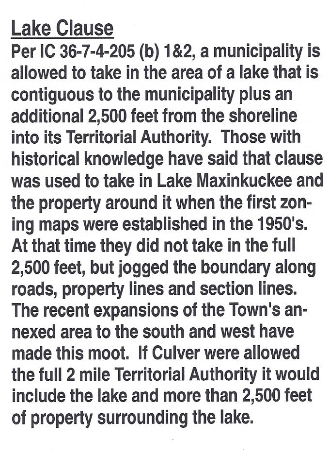
Lake ClauseBy Indiana State Statute IC 36-7-4-205, municipalities are allowed to take in contiguous unincorporated areas outside of their annexed municipal limits as extended Territorial Authority via their Comprehensive Plan. This is often referred to as the “two mile zoning boundary” as that is the maximum allowed by statute.  Even though it is often referenced as the Two Mile Zoning Boundary in discussions at the Culver Plan Commission, and it is labeled that way on the map on the wall, Culver has never had the entire allowed area.  In the case of municipalities such as Culver which are adjacent to lakes, the municipality is allowed to take in the lake and the property surrounding it.  (See comments on the clause regarding lakes excerpted to the right.)

My understanding is the premise of this statute dates back to the growth spurt Indiana and the rest of the nation experienced after World War II.   Often that growth occurred in the fringe areas around municipalities in a chaotic manner.  In most cases there was no county zoning at the time, so Indiana and other states granted their municipalities the extended territorial authority to apply zoning standards to the fringe areas.  This extended authority varied by state and I found examples of it extending from 1 to 4 miles outside municipal boundaries.  In the case of Indiana, most counties have zoning ordinances now, but the extended boundary is still used by communities to control the area of imminent growth at their perimeter.  Imminent growth around Culver is probably something that I’ll hear arguments about.  In this case “imminent” needs to be judged by the life of our community, not by our short personal lifetimes.  Imminent for Culver should be looked at through the lens of the future, looking forward 2o or even 50 years.

At the time the current zoning boundary was created, Culver was actually pretty progressive and was one of the first communities in Marshall County to establish a Plan Commission and a Zoning District.    According to Pete Trone and Bobbie Ruhnow, my planning and zoning historical references, Culver took partial advantage of the territorial authority allowed and included Lake Maxinkuckee in its zoning district.  The Plan Commission did not take in the full two miles at the time because they didn’t want to clash with the farm community.  Since there was no County zoning at that time, there were no restrictions placed on the farmers outside the municipal limits.  In most areas the lines were drawn along section lines or from intersections without regard for parcel lines.  Thus the “problem” with the split parcels.  This issue exists mainly on the west and north.  Parcels were generally used to draw the line around the lake, so the east and south boundaries are clearer.  You can see a detailed map of Culver’s zoning boundaries here.

Culver Zoning Boundary0001
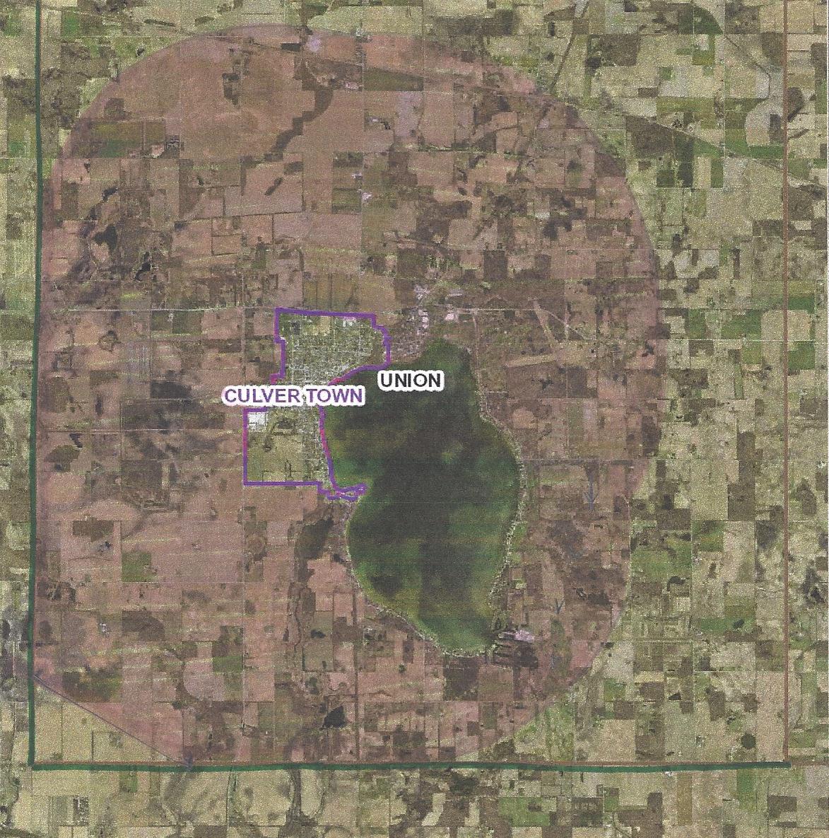
Culver’s Zoning Boundary
The pink area shows the current extended authority. The loop outside that shows the approximate limits if the Two Mile area was granted.

In meetings with the Culver Plan Commission, it has been presented that the GIS system at the County is based on the parcel lines and since the zoning boundary lines around Culver do not follow parcel lines, the transitions between zoning boundaries are too difficult to determine.  Admittedly, I am no expert in the nuts & bolts of the County GIS system.  I am confused though how this can be such a difficult issue when the system currently shows soils maps, flood zones, etc. which bisect parcels and cross parcel lines with curvilinear representation. The current plan is being promoted as “fair” because it takes the majority of the split parcels and puts them completely under Culver jurisdiction if more than 50% is currently under Culver jurisdiction.  If less than 50% is currently in Culver jurisdiction  the entire parcel will be placed under Marshall County jurisdiction.  While this is ostensibly “fair”, fairness is not the reason for the two mile boundary.  The two mile zoning boundary is provided for by the State so that a municipality can control its destiny.  Theoretically municipalities will continue to grow.  Culver should plan to grow!  In economic terms, communities are either growing or dying.  There is no Status Quo!
Culver Zoning Boundary0002
Potential Culver Zoning Boundary
There area in pink is roughly drawn two miles out from radii at the extents of the Town boundary

Culver currently does not have  the full two miles allowed in any direction.  So why are we giving up control of any of our current area?  Wouldn’t a more prudent solution to the GIS “problem” be to give all of the split parcels over to Culver’s control?  While I’m not opposed to following parcel lines for convenience, I don’t think that should mean that we lose any parcel that crosses the current line.  With a two mile extended authority our boundary would look more like the drawing to the right.  If we take in every parcel that is split by the current boundary, we would still be well within the two mile limit.  If that’s not acceptable, then I think the current boundary line should remain as is.  As per my reference to the soils and flood plain layers, I think the GIS is versatile enough to illustrate those things.  If there’s a discrepancy; bring it to the Plan Commission for a determination.

*  Thanks to Pete Trone and Bobbie Ruhnow – both provided historical reference and valuable input to my research.
Econ 101

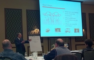
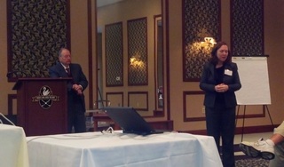
Thayr Richey (left) and Jennifer Laurent (right) speaking at the Econ 101 presentation at Swan Lake

Thursday afternoon Marshall County Economic Development Corporation (MCEDC) along with Indiana Michigan Power Agency (IMPA) hosted elected officials from Marshall County and the Marshall County municipalities.   The venue was the Swan Lake Resort Conference Center.  The speaker was Thayr Richey of Strategic Development Group (SDG).Twenty-five county and municipal representatives along with most of the MCEDC board attended the presentation;  a pretty good cross section of the county including Bill Githens, Ralph Winters, Barbara Winters, Jim Falkner, Margaret Dehne and Dave Schoeff representing Culver.  Hopefully everyone took something back to their respective communities to share and act on.  Mr. Richey spoke of Economic Development as a team sport.  It’s not something that can be done by a single person.  The communities need to pull together to make something happen in Marshall County, much as Marshall County needs to work with our neighboring counties to elevate our region.

Thayr Richey

Mr. Richey discussed Economic Development as a concept and how it has changed over the past 30 years with the advent of additional technology and the increasing globalism of our economy.  There are now over 100 local economic development offices (LEDO’s) in the State of Indiana.  He allowed Jennifer Laurent, MCEDC’s Executive Director, to speak on the specifics of what MCEDC is doing to promote Marshall County locally, regionally and nationally.  He then assessed those functions and how they related to the board and commission members in attendance.  It was good to hear that we are, for the most part, on the right track.

In discussions about site selectors, Mr. Richey told how it has almost become a game of speed dating for the LEDO’s.  You have a very limited time to make a good first impression, exchange telephone numbers and leave some kind of hook that might get you a date in the future.  Ms. Laurent told of a recent meeting she attended in Indianapolis where members of the Site Selectors Guild were present.  She said the analogy was a good one and it was a great opportunity to connect and get a feel for their individual styles.  She said she felt like she came away with positive connections to seven site selectors that were attending the event.

Dealing with new business prospects is like a game of Musical Chairs…

One of the important thing that I hope our representatives took away was the extreme competition that is out there.  We have to have a viable product to sell and we have to have all the pertinent information available to supply a prospect within days.  He went through the 200 point request for information (RFI) that Ms. Laurent receives on a regular basis, usually with a 24 or 48 hour deadline for turn-around.  One of the things that often drops us from a prospects list is the lack of interstate highway access.  “The new goal is ’55 in 5′; Companies want their trucks up to speed at 55 mph within 5 miles of their facility when they’re shipping product,” said Richey, adding, “Dealing with new business prospects and RFI’s is like a game of Musical Chairs.  Your economic development people are striving to stay relevant and make it to the next round, while the site selector is looking for reasons to eliminate them and get the potential number of sites down to manageable size.”

We discussed the ways we have of overcoming items such as the interstate request and Ms. Laurent said we have made progress with the Indiana Economic Development Corporation (IEDC) to make sure that we were not eliminated from initial searches for that.  The advent of the Internet and the ease that searches can be done online has made MCEDC’s job increasingly difficult since we are often eliminated before we even know we were being considered.  Prompted by a question from the audience, Ms. Laurent also told a little about our efforts to form a “U.S. 30 Coalition” with the objective of preserving U.S. 30 as a thoroughfare and controlling the addition of stop lights. MCEDC as well as other local LEDO’s are in discussions with the group that spearheaded the U.S. 31 Coalition to be our advocates.

Since Plymouth is currently updating their Comprehensive Plan and Culver is is the process of selecting a consultant to help update their Comprehensive Plan (A previous post about Culver’s Comprehensive Plan efforts is here.), I asked where and how economic development should fit in.  Mr. Richey said that the input of our LEDO is critical to this planning.  They can provide input into what tools they need to encourage development and they can make sure that the language in the plan dovetails into the LEDO’s marketing plan.  This is very much a case where MCEDC needs something to market.  The Comprehensive Plan should show that willingness and vision for growth.  It was emphasized several times that the current manufacturing standard of “just in time” delivery applies to site and building acquisition.  Expanding companies want properties that are “shovel ready” and each have their own interpretation of what that means.  Even better, they like to see a building that meets their needs and is ready to move into.  (MCEDC is currently working with the Plymouth Redevelopment Commission to put up a shell building as part of their marketing effort.  Discussed in the ECC blog here and on WTCA’s site here.)

Wrapping up the session, Mr. Thayer discussed the use of Tax Abatements and Tax Incremental Financing (TIF) as the two tools the State of Indiana has given Marshall County to assist with economic development.  The allowances on Tax Abatements have changed where a municipality is able to give a 100% tax abatement for up to 10 years.  The municipality has the option of adding “claw back” provisions, giving abatements for less time or a lower percentage, but the developer is always going to ask for the maximum.  This could be one of the things that pulls your chair.  (Back to the Musical Chairs reference.)  TIF Districts are being used by several of Marshall County’s communities to varying degrees of success.  He gave several tips on how they could be and should be used as well as common mistakes make by the governing bodies that used them.

All in all the presentation was informative and I think it was helpful in generating discussion amongst our County and municipal representatives.  I was pleased with those that made the effort to attend.

Constitution Day 2012

Today is Constitution Day, also known as Citizenship Day.  It was set for September 17th, the day the Constitutional Congress signed the Constitution in 1787.  It’s interesting to contemplate the Constitution in the year of a Presidential Election.  For such a simple document there seems to be a lot of “interpretation” going on.

Check out a previous post here from 2009 that includes links if you are interested in finding out more.

Culver Firemen’s Memorial at Town Council

Public Service AnouncementFor those of you looking for the Firemen’s Memorial post I discussed at the Town Council this evening, I’ve conveniently linked it here.

For those of you that couldn’t make it to the meeting, I presented the Firemen’s Memorial to the Town Council this evening.  The project is proposed for the northeast corner of the intersection of Slate Street and Lake Shore Drive.  The lot is owned by the Town and is currently used as a parking lot for the firemen.  The lot is zoned C-1.  The basic conundrum was that Culver’s Zoning Ordinance doesn’t have a designation for Monuments or Memorials no matter what the zoning district.

I had discussed this with Russ Mason, Culver’s Building Commissioner, and we agreed that the best solution was to request the Town Council to accept the structure as a Municipal Sign.  (The Town Council is exempt from ordinance requirements for their signs.)  I presented it as such to the Council this evening.  Russ was there to back me up.  After a brief discussion, the Council agreed that this was an appropriate designation for a worthy project.

This knocks down another obstacle, so the project is moving forward.  Now we’re just held up by the minor problem of fundraising…

This has been a Public Service Announcement…  If I were a little more ambitious this evening, I would find a mpg of NBC’s “The More You Know” tag music to play in  the background…

Firemen’s Memorial Sketch by Mary Ellen Rudisel Jordan of Scearce Rudisel Architects in Warsaw.