Culver Wellhead Protection Map
Map of Town of Culver wellhead aquifer area
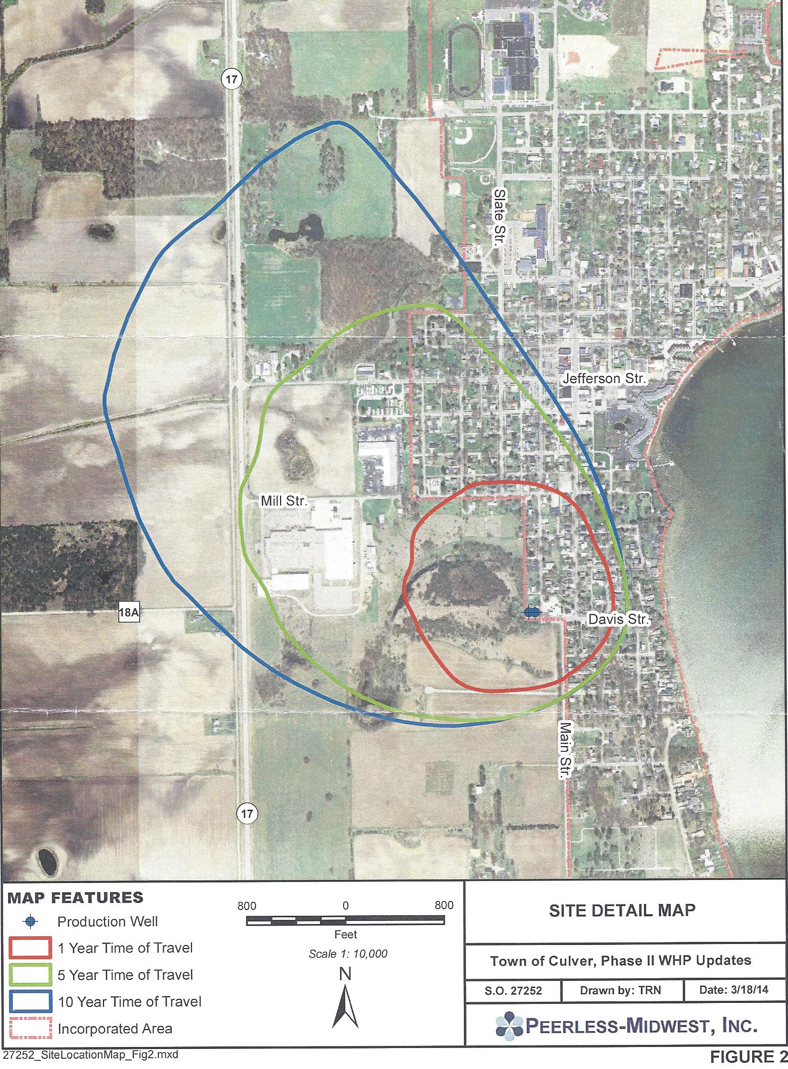
I received the handy-dandy map to the right in the mail from the Town of Culver the other day along with a letter from Dave Schoeff, Culver Town Manager, talking about various procedures for protecting the well water for Culver’s municipal wells. All of it was a good reminder as ground water contamination isn’t something that people think about on a day to day basis. I doubt many people think about where the municipal tap water comes from beyond the faucet to which it is attached. I doubt many people really looked at the map either. Aside from the weird abbreviation for street “Str.” and the random dashed line area floating above the Lutheran Church property, two other things struck me. First being that the aerial photography for the base map is old. Construction began on Culver Garden Court in 2011 and it is not shown in the photograph. The second and more interesting thing pertinent to recent discussions is that the 10 year protection line extends very close to the current Culver Zoning Boundary.
Hopefully this will be added to the list of reasons why Culver should be allowed to extend their Territorial Authority per the Comprehensive Plan. Any decisions about development in these zones should be considered against the backdrop of wellhead protection along with all the other factors. If that is the 10 year line, then the 15 year line is farther out yet, not to mention some of the locations being considered for another well might have aquifer areas even farther out. Add this to your file Dave!
Leave a Reply
Our Location:
Easterday Construction Co., Inc.
402 North Slate Street
Culver, IN 46511
Phone: (574) 842-3341
Fax: (574) 842-2629

Our Customers Say…

Ronald W Liechty - President, Garden Court, Inc.