Sand Hill Farm – Topography
Sand Hill Farm Topography
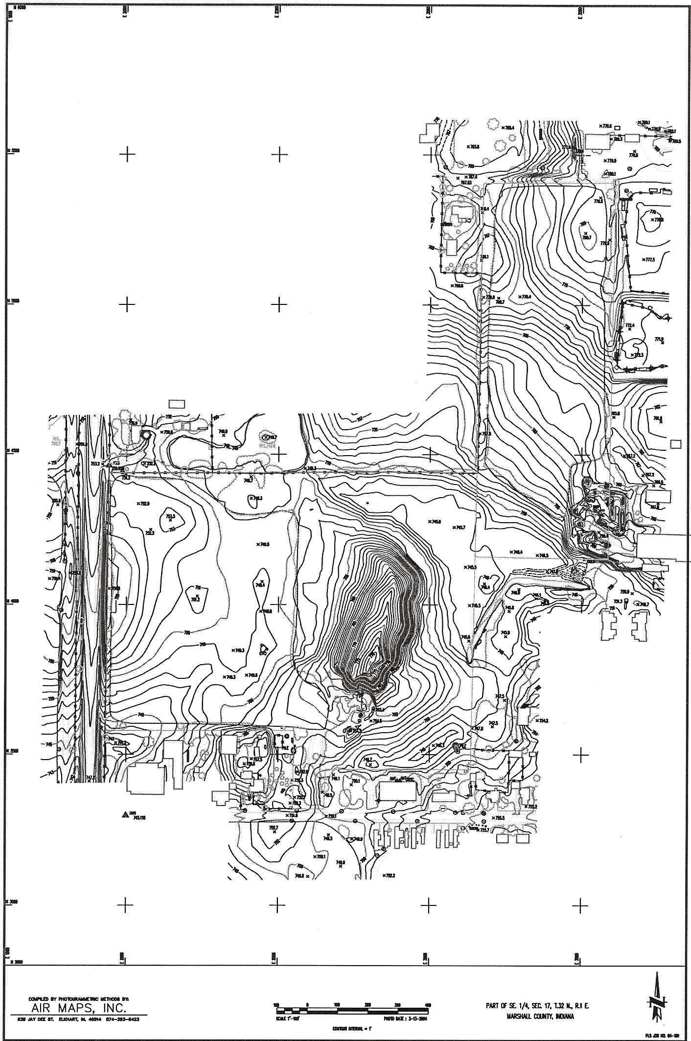
When I bought the 25 acre portion of the site at auction in 2005 there was a discrepancy in the acreage. The property was listed as approximately 28 acres, but in reality it is closer to 25. Fortunately for me the purchase documents were based on a per acre price. I split the cost of a survey with the seller. The savings were more than enough to pay for my half of the metes and bounds survey as well as allowing me to piggy back an aerial topography on top of that! As near as I can tell, the discrepancy in acreage occurred when additional right-of-way was acquired by the State for State Road 17. The County collected property taxes for decades on property that wasn’t taxable…
According to Wayne Neidlinger, whose family farm is to the north, the sand hill originally extended quite a bit further to the west, but that portion of the hill was used as fill for the highway road bed. The area west of the sand hill has developed into good farm land. The area east of the sand hill was farmed in the past, but it has been uncultivated for years and has become overgrown with scrub trees.
Two easements exist on the property that were uncovered by the survey and accompanying title work. One easement runs along the west and north property line of the 25 acre tract. This easement was purchased by United Telephone for the purpose of providing looped phone line access to Culver. As we were reminded a few weeks ago, this never occurred. The second easement is in the southeast corner where the County has a drainage easement.
There is approximately 35 feet of elevation change within the property. Interestingly, the high point on the sand hill is at the same elevation as the high point near Academy Road behind the baseball diamond. The lowest point is near the storm water detention property recently purchased by Susan Mahler at the Corner of Clymax Street and Cass Street.
3 Responses to Sand Hill Farm – Topography
Leave a Reply to Bobbie Ruhnow Cancel reply
Our Location:
Easterday Construction Co., Inc.
402 North Slate Street
Culver, IN 46511
Phone: (574) 842-3341
Fax: (574) 842-2629

Our Customers Say…

MacKenzie Ledley - Executive Director, Pulaski County Public Library
By Bobbie Ruhnow September 18, 2008 - 9:34 am
Interesting – this is the first information I’ve seen on your proposed PUD -Sand Hill Farms. Not sure I’m in agreement with a zero lot line concept for Culver. I guess we would need to have discussions about creating another zoning area. (R3).
I think your blog is informational. Didn’t realize the old sink hole had been sold.
By Bobbie Ruhnow September 18, 2008 - 9:35 am
I don’t think you have the bugs blocked from your blog, buddy
By Kevin Berger September 18, 2008 - 10:05 am
Bobbie,
One of the reasons for doing a PUD would be to experiment with some of these things before looking at them as a completely different district. The current research I’ve been reading on these things indicate that communities are going back to more mixed use in order to create “neighborhoods”. This would be an opportunity for a small experimental look at this for Culver.
The main difference in zero lot line from duplexes and townhomes (which are already allowed) is the ability to allow home ownership. The Town Council keeps talking about affordable housing and this could be a piece of that puzzle.
Kevin